Our second project in MENA class was to take our assigned country and define the SITE and SITUATION characteristics that the region was made up of. Although this project included a 4-6 page paper I decided to create visuals to the points I was trying to address.
Friday, March 9, 2012
Middle East and North Africa
Getting to more recent classes, this semester I am taking Middle East and North Africa (MENA) Geography. This is a super interesting class and the project our professor Paul Kaldjian has us doing allows for our creativity to soar. The first project we were to create our mental map of the MENA as well as a visually pleasing pie graph with examples. I decided to steer clear of Microsoft Excel and created my project with Adobe Illustrator.
Typography
Typography is the form of art by using words instead of standard shapes. Sparked by the interest of various typography maps online including the ones from Axis Maps I decided to create my own version for Eau Claire.
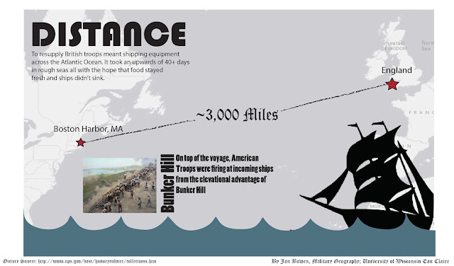
Military Geography
Our Military Geography class had a final project that consisted of identifying the evolution of first generational warfare. Although our group was misscommunitive the maps I produced were able to show how many different facets of war had evolved throughout the various battles that used first generational warfare.
Hawai'i Project
For Geography 368 last semester we all had a chance to use everything we've learned in both cultural and physical geography classes to grasp how special a place such as Hawai'i really is. The Big Island of Hawai'i was our focus and we covered everything from the highest peak to the beach. As a result of our trip we created a website. I was able to start taking my cartography skills to a graphic design direction. The following maps are a result of our class trip and our interpretation of the features we saw.
Subscribe to:
Posts (Atom)


